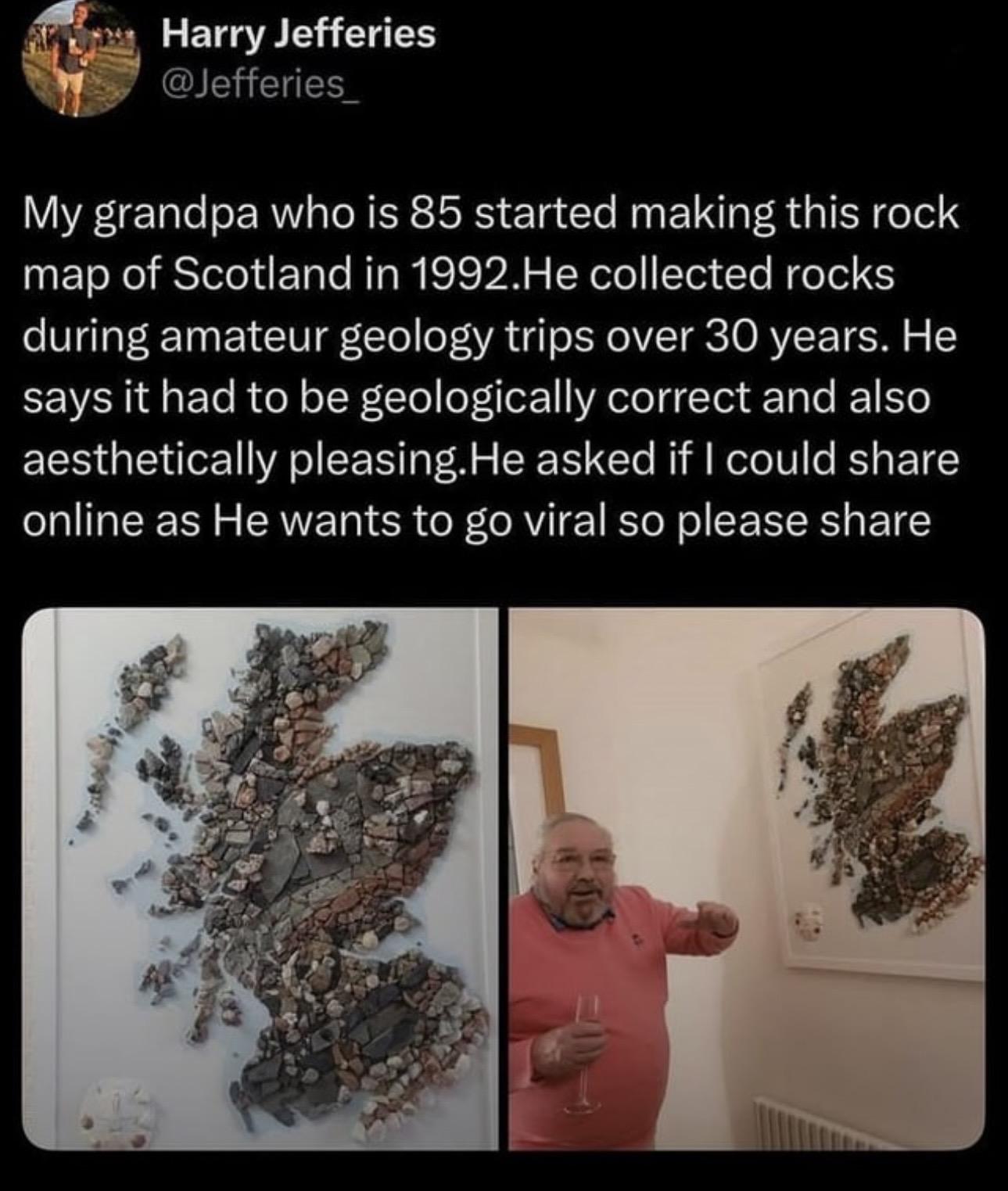
Something for friends in Scotland! I’ve followed so many this last year—Glasgow,architecture,history, geology, landscape photography, and more. I hope you like this screenshot from Reddit and a link if you want to read the story from OP, credited. #Scotland #Scottish, #Geology #RockHound #Art #Map https://www.reddit.com/r/BeAmazed/s/gzzjLRNZe9